20 Nov Lindblad Expeditions-National Geographic and Google Street View Bring Trekker Technology to South Georgia and the Falkland Islands
Lindblad Expeditions-National Geographic and Google are reinventing 21st-century exploration using Google’s Street View technology to take users to South Georgia and the Falkland Islands, one of the most rarely-visited places on Earth. On Oct. 26 the companies launched Google Street View imagery for Google Maps in South Georgia and The Falklands, coinciding with the Centennial of Ernest Shackleton’s legendary Trans-Antarctic Expedition.
Shackleton’s ship, Endurance, sailed from Buenos Aires to Antarctica on Oct. 26, 1914, and was trapped and subsequently lost in the ice. Shackleton and five crewmembers sailed a lifeboat from Elephant Island 800 miles to South Georgia to secure rescue — a feat considered among the most heroic in the annals of exploration.
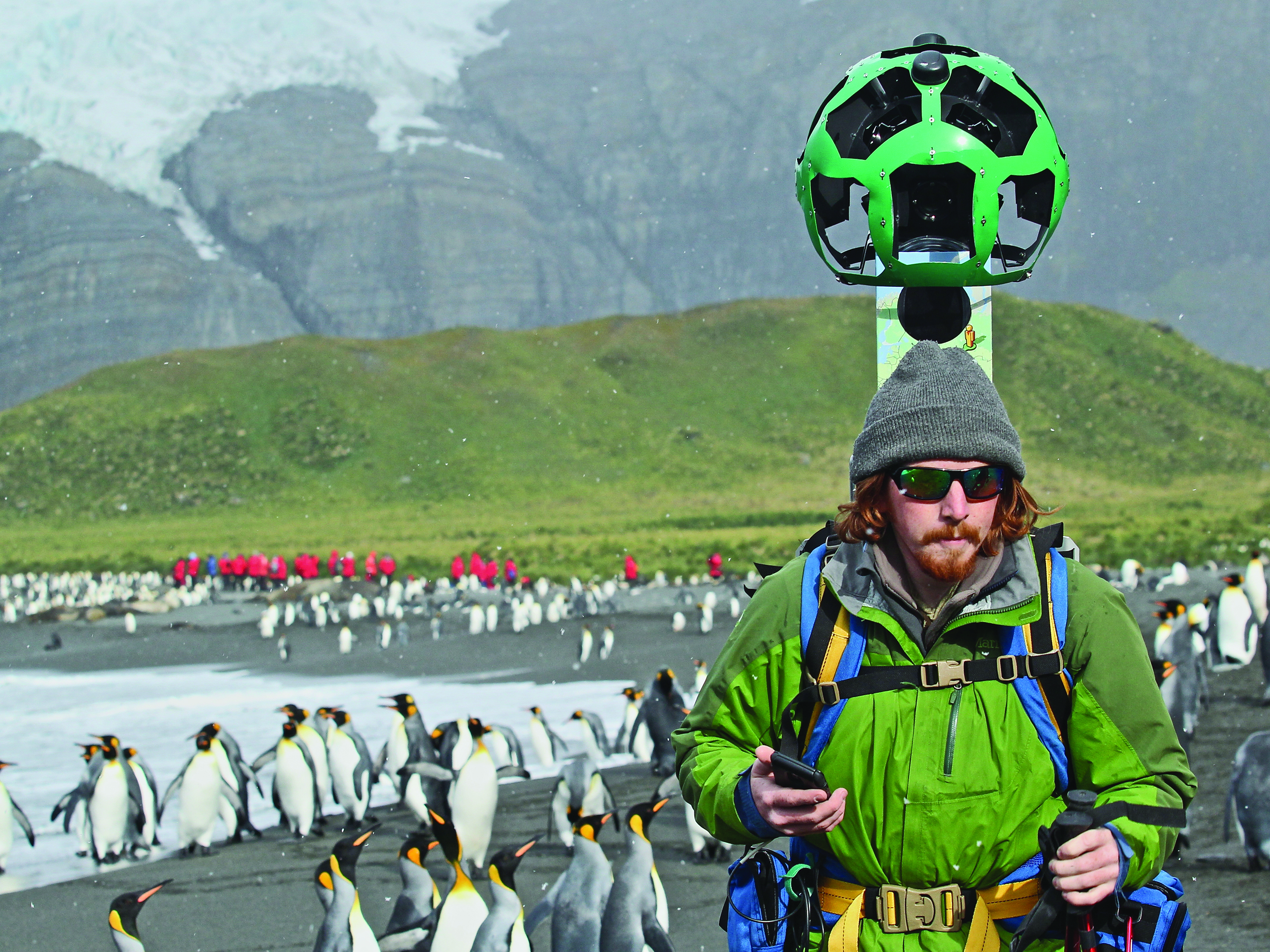
The trekker technology captured imagery that offers end users the experience of being an explorer by traveling to places where traditional vehicles – or they — cannot go, and brings together the storied past and boundless future of exploration.
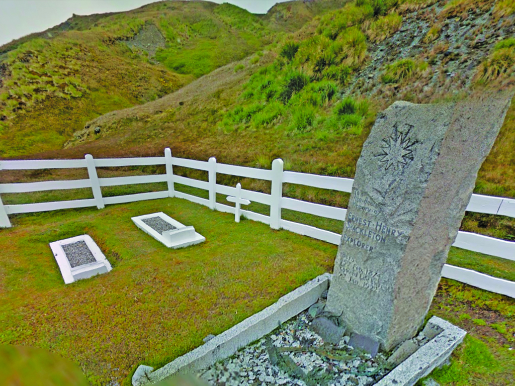
Users can discover the path of the legendary polar explorer and visit the grave of his final resting place; get up close with colonies of thousands of penguins, nesting albatross, enormous elephant seals lolling on the beach, dramatic landscapes of snowcapped mountains and tussock grasses, and much more.

In a region that provides a unique window into the continuing dangers posed by climate change, the imagery will also help to preserve what this place is today, allowing for before-and-after shots of endangered locales and species.
Part of the Trekker Loaner Program, the trek was conducted by one Lindblad Expeditions’ videographer, and yielded more than 10,000 panoramas shot at nine locations, including New Island, Carcass Island, West Point Island, Right Whale Bay, Hercules Bay, Ernest Shackleton’s Grave, Grytviken Church, Grytviken Whaling Station and Prion Island.
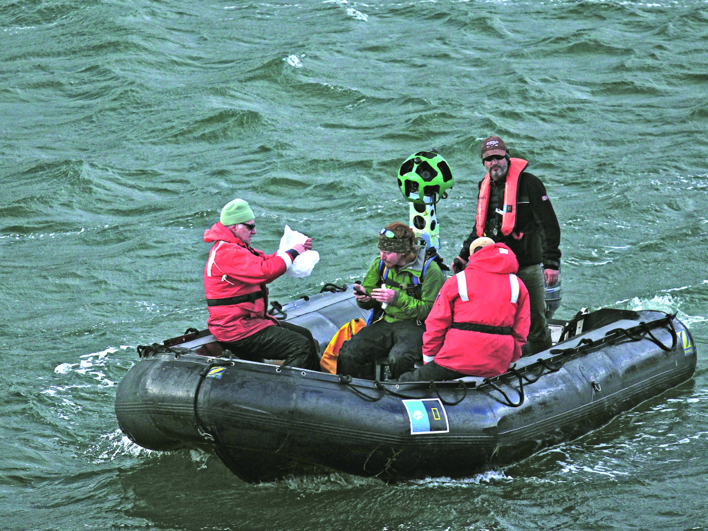
The trekker imagery was collected in March 2014 while on a Lindblad expedition onboard the 148-guest National Geographic Explorer, uniquely equipped with an ice-strengthened hull and advanced navigation equipment for polar expeditions. The trekker arrived at the remote South Atlantic locations via Zodiac landing craft deployed from the ship.
The Trekker is a backpacked camera that weighs 43 pounds, has 15 lenses, and shoots a photo every 2.5 seconds.
The live Google Street View Imagery can be found here:
South Georgia Island: https://www.google.com/maps/views/streetview/south-georgia-island?gl=us
The Falklands: https://www.google.com/maps/views/streetview/falkland-islands-islas-malvinas?gl=us
A video of the trekker training and trek can be found here: http://youtu.be/_2-5WahYl-M
Latest posts by Adventure Collection Staff (see all)
- The Guide, by Laurie Hovell McMillin - October 4, 2017
- A Single Step: Travel Independence in Ghana by Mridu Khullar Relph - July 12, 2017
- Small Lights in Large Darkness by Rebecca Dinerstein - May 31, 2017


No Comments